What are the Benefits of drone surveying
In recent years, the use of drones in surveying has become increasingly popular. Drone surveying offers a number of advantages over traditional methods, including increased accuracy and efficiency. In this blog article, we will explore the benefits of utilising drone technology for aerial mapping and uncover new possibilities in surveying with drones. We will also discuss how harnessing the power of drone technology can help you get more accurate results faster than ever before. Read on to learn more about why drone surveying is becoming an invaluable tool for surveyors around the world!
Drone surveying is an increasingly popular method of collecting data for a variety of applications. This technology has revolutionised the way surveyors collect data, allowing them to access difficult-to-reach areas with ease and accuracy. Drones are also able to capture high-resolution images and videos that can be used for detailed analysis. Here are some of the key benefits of using drone surveying:
1) Cost Savings: Drone surveys can save time and money by eliminating the need for costly equipment rentals or personnel costs associated with traditional methods such as ground surveys or aerial photography. Additionally, drones require minimal setup time compared to other methods, resulting in faster results at a lower cost.
2) Accuracy: Drone surveying offers highly accurate results due to its ability to capture high-resolution images from multiple angles simultaneously. The use of GPS technology ensures precise measurements which can be used in various mapping applications such as topographical maps or 3D models.
3) Safety: By removing people from hazardous environments, drone surveys reduce risks associated with manual labour while still providing accurate data collection capabilities without compromising safety standards. In addition, drones have low operational noise levels which make them ideal for sensitive areas where noise pollution must be kept at a minimum level (e..g wildlife reserves).
4) Flexibility & Versatility: Drones offer flexibility when it comes to capturing data from different angles and heights making it possible to get more comprehensive coverage than what is achievable through traditional methods like ground-based surveyors or aerial photography. Furthermore, they allow users to access hard-to-reach locations that would otherwise not be accessible.
5) Efficiency: With their ability to cover large distances quickly, drones enable the efficient collection of vast amounts of information within short periods. This makes them ideal tools for monitoring projects over extended periods as well as responding quickly during emergency situations.
6 ) Environmental Impact Reduction: As opposed to conventional survey techniques, drone surveys do not require any additional resources such as fuel consumption thus reducing environmental impact significantly. Moreover, they produce less waste since no physical markers need installation onsite unlike other forms of land surveying techniques requiring stakes etcetera
In conclusion, there are many advantages offered by drone surveying including cost savings, accuracy,, safety, flexibility & versatility, efficiency, and reduced environmental impact.
Uncovering the Advantages of Drone Surveying
The use of drones for surveying has become a popular choice, and with good reason. Making it an attractive option for many industries. From cost savings to increased safety and accuracy, the benefits of drone surveying are undeniable.

One major advantage is cost savings. Traditional survey methods require expensive equipment such as helicopters or planes to access hard-to-reach areas or take aerial photographs; however, drones can do this at a fraction of the cost. Additionally, since they don’t need any fuel or personnel costs associated with manned aircraft, they offer significant financial savings compared to other options available on the market today.
Another benefit is improved safety and accuracy when conducting surveys from above ground level – something that’s not possible using traditional survey techniques due to their limited reach and visibility restrictions imposed by height regulations in certain countries around the world. With drone technology now allowing us to capture data from previously inaccessible locations without putting anyone’s life at risk – it makes sense why so many companies are turning towards this method for their projects!
Finally, another great advantage offered by drone surveys is speed: while traditional survey techniques may take days or even weeks depending on weather conditions etc., drones can often complete a job within hours – saving valuable time which could be spent elsewhere on more important tasks instead! This also means that you get your results quicker than ever before – giving you an edge over competitors who might still be relying on outdated methods like manual labour alone!
In conclusion, there are numerous advantages associated with using drones for surveying purposes; from reduced costs through improved safety & accuracy right to faster turnaround times – these benefits make them an ideal choice for any project requiring detailed information about land features quickly & efficiently!
Exploring the Benefits of Utilising Drone Technology

The use of drone technology is becoming increasingly popular for surveying purposes. This cutting-edge technology provides a range of benefits that can be utilised to improve the accuracy and efficiency of surveying projects. From providing aerial imagery to creating 3D models, drones are revolutionising the way we survey land and structures.
One major benefit that comes with using drone technology is its ability to provide detailed aerial imagery in a fraction of the time it would take traditional methods such as helicopters or planes. Drones are able to capture high-resolution images from multiple angles, allowing surveyors to get an accurate view of their project area without having to leave the ground. Additionally, drones can also be used for thermal imaging which allows surveyors to identify potential issues before they become costly problems down the line.
Another advantage offered by utilising drone technology is its ability to create 3D models quickly and accurately with minimal effort on behalf of surveyors; this makes it ideal for large-scale projects where data needs collecting from various points across a wide area in a short amount of time. With GPS-enabled drones, users can easily map out areas that may have been previously inaccessible due to cost or safety reasons – making them invaluable tools when conducting surveys in remote locations or hazardous environments.
Finally, one key benefit associated with using drone technology lies within its affordability; compared to traditional methods such as helicopters or planes, operating costs associated with running drones tend much lower – meaning businesses save money while still being able to reap all rewards provided by this innovative form surveying.
In conclusion, there is no denying the fact that incorporating drone technology into your next surveying project will bring numerous advantages; not only does offer improved accuracy and speed but also reduced operational costs – making it the perfect choice for anyone looking to maximise results while minimising expenditure!
Harnessing the Power of Aerial Mapping with Drones
Drones are revolutionising the way we capture data and conduct aerial mapping. With their ability to fly autonomously, drones can quickly and accurately map large areas with minimal effort. This technology has opened up a world of possibilities for surveying professionals who need to collect accurate data in an efficient manner.

Using drone surveying, surveyors can gather high-resolution images from above that provide detailed information about terrain features such as elevation changes, vegetation types, water bodies and more. The imagery captured by drones is also much more precise than traditional methods of aerial mapping due to its higher resolution capabilities. Furthermore, this type of imaging allows surveyors to identify potential problems before they become costly issues down the line – saving time and money in the long run!
The use of drone surveying also offers a number of other benefits including improved safety for personnel onsite; reduced costs associated with traditional methods; faster turnaround times; increased accuracy when collecting data; better access to difficult or remote locations; improved collaboration between teams working on projects remotely or across different sites; and enhanced decision making capabilities through real-time analysis using 3D models created from collected imagery.
Overall, harnessing the power of aerial mapping with drones provides numerous advantages over traditional methods – allowing surveyors to maximise efficiency while minimising risk when gathering critical information about a project site or area under study.
Unlocking New Possibilities in Surveying with Drones

Unmanned aerial vehicles (UAVs) or drones are revolutionising the surveying industry, unlocking new possibilities that were previously unimaginable. Drone surveying is a cost-effective and efficient way to collect data from hard-to-reach areas, providing accurate results in a fraction of the time it would take with traditional methods.
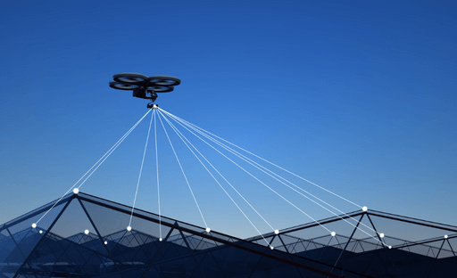
The use of drones for surveying has become increasingly popular due to their ability to capture high-resolution images and videos from any angle or height. This allows surveyors to get an overview of large sites quickly and accurately without having to physically go onsite.
Drones can also be used for 3D mapping, creating detailed models that provide valuable insights into terrain features such as elevation changes, vegetation cover, water bodies etc., which can then be used for various applications such as land management planning and infrastructure development projects.
Furthermore, drone surveys are much safer than traditional methods since they don’t require personnel on site; this reduces risk exposure significantly while still delivering precise results in record time. By using advanced technologies like LiDAR sensors mounted on UAVs surveyors can measure distances up to several kilometres away with pinpoint accuracy even in difficult weather conditions like fog or rain – something impossible with conventional tools!
Overall drone surveys offer numerous advantages over traditional approaches including increased safety levels; reduced costs; improved efficiency; enhanced accuracy & precision; faster turnaround times & more comprehensive data collection capabilities – making them ideal for many different types of surveying projects today!
Drone survey equipment

Drone survey equipment is revolutionising the surveying industry. With its advanced technology, it enables professionals to capture data quickly and accurately from a variety of angles. This makes it ideal for a wide range of applications such as mapping, construction site monitoring and inspections, topographical surveys and more.
The benefits of using drone survey equipment are numerous. Firstly, drones can cover large areas in a fraction of the time that traditional methods take – meaning projects can be completed faster with less disruption to surrounding areas. Secondly, they provide access to hard-to-reach places which would otherwise be difficult or dangerous for humans to reach on foot or by vehicle – making them invaluable for inspecting buildings or structures in remote locations.
Thirdly, their high-resolution cameras allow detailed images to be captured from multiple perspectives which can then be used for accurate measurements when creating 3D models or maps – something that was previously impossible without expensive aerial photography services. Finally, their portability means they are easily transportable between sites so you don’t have to worry about having dedicated staff at each location – saving both time and money!
Overall there is no doubt that drone survey equipment has made surveying easier than ever before – allowing professionals across industries like engineering & construction; agriculture; mining & resources; infrastructure development; urban planning.
Will drones replace surveyors?
The use of drones in surveying is becoming increasingly popular and for good reason. Drones offer a cost-effective alternative to traditional survey methods, providing higher accuracy and faster results. But could they eventually replace surveyors altogether?
The answer is yes – but not just yet. While technology has advanced rapidly in recent years, there are still limitations that prevent drones from completely replacing traditional surveying techniques. For example, drone surveys require clear skies and cannot be used in areas with tall buildings or trees that block their line of sight. Additionally, some types of surveys may require more detailed data than what can currently be collected by a drone alone; this data must then be supplemented by other sources such as ground control points or aerial photography taken from manned aircraft or satellites.
Despite these limitations, it’s clear that drones have already made an impact on the surveying industry – both positively and negatively – and will continue to do so as technology advances further over time. The advantages offered by drone-based surveys are undeniable: they provide greater efficiency at lower costs compared to traditional methods while also reducing safety risks associated with manual labour on dangerous sites like construction sites or hazardous environments like mineshafts. As such, it’s likely that we’ll see an increasing number of companies turning towards unmanned aerial vehicles (UAVs) for their surveying needs in the near future – even if they don’t completely replace surveyors just yet!


2 Responses
I like that you talked about how drone surveying is an increasingly popular method of collecting data for a variety of applications. I was watching a TV show while eating yesterday and I saw how one construction company used drones for their land surveying. I heard before that there are now companies that offer drone surveying services, which sounds really useful.
I like that you pointed out how large areas can be covered in a fraction of time compared to traditional methods when using drones which means that the project is finished faster with less disruption. It seems like people who need surveying services would benefit from a company that has different types of equipment like the RTK5 GPS package. And i can imagine how it will save them money as well because labor costs can be reduced if the job is finished as soon as possible.